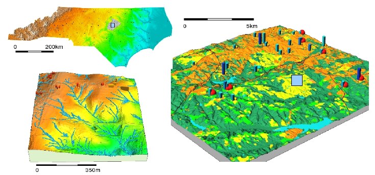
Map of NC, USA - the county with most detailed data in this data set is Wake county (city Raleigh), located close the the barycenter of NC).
Map of NC, USA - the county with most detailed data in this data set is
Wake county (city Raleigh), located close the the barycenter of NC).
download package (nc_spm_XX_2007_DATE.tar.gz)
-----------------------------
Raster data, Mapset PERMANENT
-----------------------------
aspect:               South-West Wake county: Aspect [degrees from east] (asp_ned10m)
basin_50K:            South-West Wake county: Watersheds derived from 30m NED (basin_50K)
boundary_county_500m: North Carolina county boundaries (boundary_county_500m)
cfactorbare_1m:       Rural area: C-factor with fields bare (cfactor_1m)
cfactorgrow_1m:       Rural area: C-factor for growing season (cfactor_grown_1m)
el_D782_6m:           NC Flood lidar-based 6m(20ft) DEM (elevlid_D78200WC_6m)
el_D783_6m:           NC Flood lidar-based 6m(20ft) DEM (elevlid_D78300WC_6m)
el_D792_6m:           NC Flood lidar-based 6m(20ft) DEM (elevlid_D79200WC_6m)
el_D793_6m:           NC Flood lidar-based 6m(20ft) DEM (elevlid_D79300WC_6m)
elevation:            South-West Wake county: Elevation NED 10m (elev_ned10m)
elevation_shade:      South-West Wake county: Shaded relief (elevation.shade)
elev_lid792_1m:       Rural area: Lidar-based 1m DEM (elev_lid79200_1m)
elev_ned_30m:         South-West Wake county: National Elevation Data 30m (elev_ned30m)
elev_srtm_30m:        South-West Wake county: SRTM-V1 30m terrain surface model (myelev_srtm3010m)
elev_state_500m:      North Carolina DEM 500m (elev_state_500m)
facility:             Rural area: Footprint of planned facility (facility)
geology_30m:          South-West Wake county: geology derived from vector map (geology_30m)
lakes:                South-West Wake county: Wake county lakes (lakes)
landclass96:          South-West Wake county: Simplified landuse classes (landclass)
landcover_1m:         Rural area: Landcover (landcov)
landuse96_28m:        South-West Wake county: NC Land Use 1996 clipped (landuse96_28m_cut)
lsat7_2002_10:        LANDSAT-TM7 Band 1 Visible (0.45-0.52um) 30m (lsat7_2002_10)
lsat7_2002_20:        LANDSAT-TM7 Band 2 Visible (0.52-0.60um) 30m (lsat7_2002_20)
lsat7_2002_30:        LANDSAT-TM7 Band 3 Visible (0.63-0.69um) 30m (lsat7_2002_30)
lsat7_2002_40:        LANDSAT-TM7 Band 4 Near Infrared (NIR) (0.76-0.90um) 30m (lsat7_2002_40)
lsat7_2002_50:        LANDSAT-TM7 Band 5 Near Infrared (NIR) (1.55-1.75um) 30m (lsat7_2002_50)
lsat7_2002_61:        LANDSAT-TM7 Band 6 Thermal (10.40-12.50um) 60m Low Gain (lsat7_2002_61)
lsat7_2002_62:        LANDSAT-TM7 Band 6 Thermal (10.40-12.50um) 60m High Gain (lsat7_2002_62)
lsat7_2002_70:        LANDSAT-TM7 Band 7 Mid Infrared (MIR) (2.08-2.35um) 30m (lsat7_2002_70)
lsat7_2002_80:        LANDSAT-TM7 Band 8 Panchromatic (PAN) (0.52-0.90um (15m) (lsat7_2002_80)
ncmask_500m:          North Carolina boundary MASK (ncmask_500m)
ortho_2001_t792_1m:   Rural area (792 tile) NC Flood Orthophoto 2001 (ortho_2001_1mtest2)
roadsmajor:           South-West Wake county: roadsmajor (roadsmajor)
slope:                South-West Wake county: slope in degrees (slope_ned10m)
soilsID:              South-West Wake county: Soils: ID (soilsID_wake_10mi)
soils_Kfactor:        Rural area: Soils: K-factor (kfactornew_1m)
streams_derived:      South-West Wake county: Streams derived from 10m DEM (streams_derived)
towns:                South West Wake: Cities and towns derived from zipcodes (towns)
urban:                South West Wake: Urban areas derived from vector map (urban)
zipcodes:             South West Wake: Zipcode areas derived from vector map (zipcodes_int)
zipcodes_dbl:         South West Wake: Zipcode areas from vector map, fp (zipcodes_dbl)

---------------------------
Raster data, Mapset landsat
---------------------------
lsat5_1987_10: LANDSAT-TM5 Band 1 Visible (0.45-0.52um) 30m (lsat5_1987_10)
lsat5_1987_20: LANDSAT-TM5 Band 2 Visible (0.52-0.60um) 30m (lsat5_1987_20)
lsat5_1987_30: LANDSAT-TM5 Band 3 Visible (0.63-0.69um) 30m (lsat5_1987_30)
lsat5_1987_40: LANDSAT-TM5 Band 4 Near Infrared (NIR) (0.76-0.90um) 30m (lsat5_1987_40)
lsat5_1987_50: LANDSAT-TM5 Band 5 Near Infrared (NIR) (1.55-1.75um) 30m (lsat5_1987_50)
lsat5_1987_60: LANDSAT-TM5 Band 6 Thermal (10.40-12.50um) 120m (lsat5_1987_60)
lsat5_1987_70: LANDSAT-TM5 Band 7 Mid Infrared (MIR) (2.08-2.35um) 30m (lsat5_1987_70)
lsat7_2000_10: LANDSAT-TM7 Band 1 Visible (0.45-0.52um) 30m (lsat7_2000.1)
lsat7_2000_20: LANDSAT-TM7 Band 2 Visible (0.52-0.60um) 30m (lsat7_2000.2)
lsat7_2000_30: LANDSAT-TM7 Band 3 Visible (0.63-0.69um) 30m (lsat7_2000.3)
lsat7_2000_40: LANDSAT-TM7 Band 4 Near Infrared (NIR) (0.76-0.90um) 30m (lsat7_2000.4)
lsat7_2000_50: LANDSAT-TM7 Band 5 Near Infrared (NIR) (1.55-1.75um) 30m (lsat7_2000.5)
lsat7_2000_61: LANDSAT-TM7 Band 6 Thermal (10.40-12.50um) 60m Low Gain (lsat7_2000)
lsat7_2000_70: LANDSAT-TM7 Band 7 Mid Infrared (MIR) (2.08-2.35um) 30m (lsat7_2000.6)
lsat7_2000_80: LANDSAT-TM7 Band 8 Panchromatic (PAN) (0.52-0.90um (15m) (lsat7_2000)

-----------------------------
Vector data, Mapset PERMANENT
-----------------------------
boundary_county:       North Carolina county boundaries (polygon map)
boundary_municp:       North Carolina municipality boundaries (polygon map)
bridges:               North Carolina selected bridges (points map)
busroute1:             NC State University bus service Wolfline route 1 (lines map)
busroute11:            NC State University bus service Wolfline route 11 (lines map)
busroute6:             NC State University bus service Wolfline route 6 (lines map)
busroute_a:            NC State University bus service Wolfline route A (lines map)
busroutesall:          NC State University bus service Wolfline all routes (lines map)
busstopsall:           NC State University bus service Wolfline busstops (points map)
censusblk_swwake:      Wake County census blocks with attributes, clipped (polygon map)
census_wake2000:       Wake County census tracts 2000 (polygon map)
comm_colleges:         Wake County community colleges  (points map)
elev_lid792_bepts:     Rural area (in tile 792), bare earth lidar point cloud (points map)
elev_lid792_cont1m:    Rural area, 1m elevation contours from lidar-based DEM
elev_lid792_randpts:   Rural area (in tile 792), random points from lidar-based DEM
elev_lidrural_mrpts:   Rural area multiple return lidar point cloud (points map)
elev_lidrural_mrptsft: Multiple return lidar point cloud for rural_1m region (points map)
elev_ned10m_cont10m:   South-West Wake 10m elevation contours from 10m NED
firestations:          Wake county fire stations (points map)
geodetic_pts:          North Carolina geodetic points (points map)
geodetic_swwake_pts:   South-West Wake geodetic points (points map)
geology:               North Carolina geology map (polygon map)
geonames_NC:           North Carolina geonames (points map)
geonames_wake:         Wake county geonames (points map)
hospitals:             North Carolina hospitals (points map)
lakes:                 Wake County lakes (polygon map)
nc_state:              NC State map (polygon map)
overpasses:            North Carolina NCDOT overpasses
P079214:               Raleigh detailed planimetrics, tile P079214
P079215:               Raleigh detailed planimetrics, tile P079215 (polygon map)
P079218:               Raleigh detailed planimetrics, tile P079218
P079219:               Raleigh detailed planimetrics, tile P079219
poi_names_wake:        Wake County points of interest (points map)
precip_30ynormals:     North Carolina 30 year precipitation normals
precip_30ynormals_3d:  North Carolina 30 year precipitation normals (3D)
railroads:             North Carolina railroads (lines map)
roadsmajor:            Wake County major highways and roads (lines map)
schools_wake:          Wake County schools (points map)
soils_general:         North Carolina general soils map (polygon map)
soils_wake:            South-West Wake County soils map (polygon map)
streams:               South-West Wake streams (lines map)
streets_wake:          Wake County roads and streets (lines map)
swwake_10m:            South-West Wake region boundary (polygon map)
urbanarea:             North Carolina urban areas (polygon map)
usgsgages:             North Carolina USGS gages (points map)
zipcodes_wake:         Wake County zip codes (polygon map)

------------------------------------
Predefined regions, Mapset PERMANENT
------------------------------------
nc_500m rural_1m swwake_10m swwake_30m wake_30m