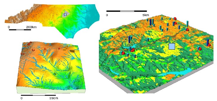
Map of NC, USA - the county with most detailed data in this data set is Wake county (city Raleigh), located close the the barycenter of NC).
Map of NC, USA - the county with most detailed data in this data set is
Wake county (city Raleigh), located close the the barycenter of NC).
download package (nc_spm_XX_2007_DATE.tar.gz)
----------------------------------------------
raster files available in mapset PERMANENT:
aspect             aspect counterclockwise in degrees from east
basin_50K          Watershed basins
boundary_county_500m boundary_county_500m
cfactorbare_1m     C-factor with fields bare
cfactorgrow_1m     C-factor for growing season
elev_lid792_1m     Lidar-based 1m DEM
elev_ned_30m       National Elevation Data 30m
elev_srtm_30m      SRTM-V1 30m terrain surface model
elev_state_500m    Statewide DEM 500m
elevation          Elevation NED 10m
elevation_shade    Shaded relief of "elevation"
elevlid_D782_6m    NC Flood lidar-based 6m(20ft) DEM
elevlid_D783_6m    NC Flood lidar-based 6m(20ft) DEM
elevlid_D792_6m    NC Flood lidar-based 6m(20ft) DEM
elevlid_D793_6m    NC Flood lidar-based 6m(20ft) DEM
facility           Footprint of planned facility
geology_30m        Geology derived from vector map
lakes              Wake county lakes
landclass96        Simplified landuse classes
landcover_1m       Landcover rural
landuse96_28m      NC Land Use 1996 clipped
lsat7_2002_10      LANDSAT-TM7 Band 1 Visible (0.45-0.52um) 30m
lsat7_2002_20      LANDSAT-TM7 Band 2 Visible (0.52-0.60um) 30m
lsat7_2002_30      LANDSAT-TM7 Band 3 Visible (0.63-0.69um) 30m
lsat7_2002_40      LANDSAT-TM7 Band 4 Near Infrared (NIR) (0.76-0.90um) 30m
lsat7_2002_50      LANDSAT-TM7 Band 5 Near Infrared (NIR) (1.55-1.75um) 30m
lsat7_2002_61      LANDSAT-TM7 Band 6 Thermal (10.40-12.50um) 60m Low Gain
lsat7_2002_62      LANDSAT-TM7 Band 6 Thermal (10.40-12.50um) 60m High Gain
lsat7_2002_70      LANDSAT-TM7 Band 7 Mid Infrared (MIR) (2.08-2.35um) 30m
lsat7_2002_80      LANDSAT-TM7 Band 8 Panchromatic (PAN) (0.52-0.90um (15m)
ncmask_500m        MASK of North Carolina state
ortho_2001_t792_1m NC Flood Orthophoto 2001
roadsmajor         roadsmajor
slope              slope in degrees
soilsID            Soils: ID
soils_Kfactor      Soils: K-factor
streams_derived    Streams derived from 10m DEM
towns              Cities and towns
urban              urban
zipcodes           Zipcode areas derived from vector map
zipcodes_dbl       zipcodes_dbl

----------------------------------------------
----------------------------------------------
raster files available in mapset landsat:
lsat5_1987_10      LANDSAT-TM5 Band 1 Visible (0.45-0.52um) 30m
lsat5_1987_20      LANDSAT-TM5 Band 2 Visible (0.52-0.60um) 30m
lsat5_1987_30      LANDSAT-TM5 Band 3 Visible (0.63-0.69um) 30m
lsat5_1987_40      LANDSAT-TM5 Band 4 Near Infrared (NIR) (0.76-0.90um) 30m
lsat5_1987_50      LANDSAT-TM5 Band 5 Near Infrared (NIR) (1.55-1.75um) 30m
lsat5_1987_60      LANDSAT-TM5 Band 6 Thermal (10.40-12.50um) 120m
lsat5_1987_70      LANDSAT-TM5 Band 7 Mid Infrared (MIR) (2.08-2.35um) 30m
lsat7_2000_10      LANDSAT-TM7 Band 1 Visible (0.45-0.52um) 30m
lsat7_2000_20      LANDSAT-TM7 Band 2 Visible (0.52-0.60um) 30m
lsat7_2000_30      LANDSAT-TM7 Band 3 Visible (0.63-0.69um) 30m
lsat7_2000_40      LANDSAT-TM7 Band 4 Near Infrared (NIR) (0.76-0.90um) 30m
lsat7_2000_50      LANDSAT-TM7 Band 5 Near Infrared (NIR) (1.55-1.75um) 30m
lsat7_2000_61      LANDSAT-TM7 Band 6 Thermal (10.40-12.50um) 60m Low Gain
lsat7_2000_70      LANDSAT-TM7 Band 7 Mid Infrared (MIR) (2.08-2.35um) 30m
lsat7_2000_80      LANDSAT-TM7 Band 8 Panchromatic (PAN) (0.52-0.90um (15m)

----------------------------------------------
----------------------------------------------
vector files available in mapset PERMANENT:
P079215            Raleigh detailed planimetrics, tile P079215 (polygon map)
boundary_county    North Carolina county boundaries (polygon map)
boundary_municp    North Carolina municipality boundaries (polygon map)
bridges            North Carolina selected bridges (points map)
busroute1          NC State University bus service Wolfline route 1 (lines map)
busroute11         NC State University bus service Wolfline route 11 (lines map
busroute6          NC State University bus service Wolfline route 6 (lines map)
busroute_a         NC State University bus service Wolfline route A (lines map)
busroutesall       NC State University bus service Wolfline all routes (lines m
busstopsall        NC State University bus service Wolfline busstops (points ma
census_wake2000    Wake County census tracts 2000 (polygon map)
censusblk_swwake   Wake County census blocks with attributes, clipped (polygon
comm_colleges      Wake County community colleges  (points map)
elev_contour_3m
elev_lid792_bepts  Bare earth lidar point cloud, tile 792 (points map)
elev_lid792_cont1m
elev_lid792_randpts Random points generated from lidar-based DEM for tile 792 (p
elev_lidrural_mrpts Multiple return lidar point cloud for rural_1m region (point
elev_ned10m_cont10m South-West Wake 10m elevation contours derived from 10m NED (
firestations       Wake county fire stations (points map)
geodetic_pts       North Carolina geodetic points (points map)
geodetic_swwake_pts South-West Wake geodetic points (points map)
geology            North Carolina geology map (polygon map)
hospitals          North Carolina hospitals (points map)
lakes              Wake County lakes (polygon map)
overpasses         North Carolina NCDOT overpasses
precip_30ynormals  North Carolina 30 year monthly and annual precipitation norm
precip_30ynormals_3d
railroads          North Carolina railroads (lines map)
roadsmajor         Wake County major highways and roads (lines map)
schools_wake       Wake County schools (points map)
soils_general      North Carolina general soils map (polygon map)
soils_wake         Wake County soils (polygon map)
streams            South-West Wake streams (lines map)
streets_wake       Wake County roads and streets (lines map)
swwake_10m         South-West Wake region boundary (polygon map)
urbanarea          North Carolina urban areas (polygon map)
usgsgages          North Carolina USGS gages (points map)
zipcodes_wake      North Carolina ZIP code areas (polygon map)

----------------------------------------------
----------------------------------------------
region definition files available in mapset PERMANENT:
nc_500m       previous_zoom rural_1m      swwake_10m    swwake_30m
wake_30m

----------------------------------------------